AI-powered maritime decision support platformthat helps companies and teams win more business, cut manual work, collaborate as a team, and deliver better service through data driven insight.
AI needs data to thrive but when data is trapped in silos, insight suffers. The ShipIntel Concept is a fully integrated system that breaks down these barriers, enabling context-rich analysis and smarter outputs.
The ShipIntel Concept:Is built in close collaboration with users, and evolves through real feedback to help you make more qualified decisions based on data driven insight.
Gives you high quality AIS data, publicly available maritime data and essential maritime features in one seamless solution at an affordable price.
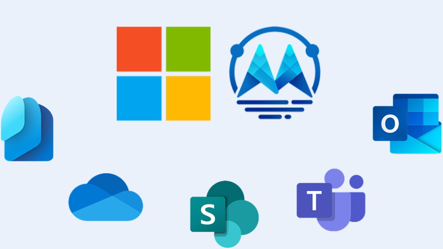
Is an intuitive, flexible, and affordable solution and can be seamlessly integrated with your Microsoft 365 products.
Plan faster. Work smarter. Earn more.


Information workers in the maritime industry spend a significant amount of time on manual, repetitive tasks.
On average they spend at least a quarter of their work week on such tasks, including email, data collection, and data entry.
On average, information workers switch between 10 apps up to 25 times a day (and you pay several license fees).
In about 60 percent of occupations, at least one-third of the activities that make up a specific job could be automated.
Employees report spending only 33% of their day on the job they were hired to do with the balance of their day spent jumping from platform to platform.
60 % of enterprises are less than halfway to upgrading their app inventories to meet modern work scenarios.
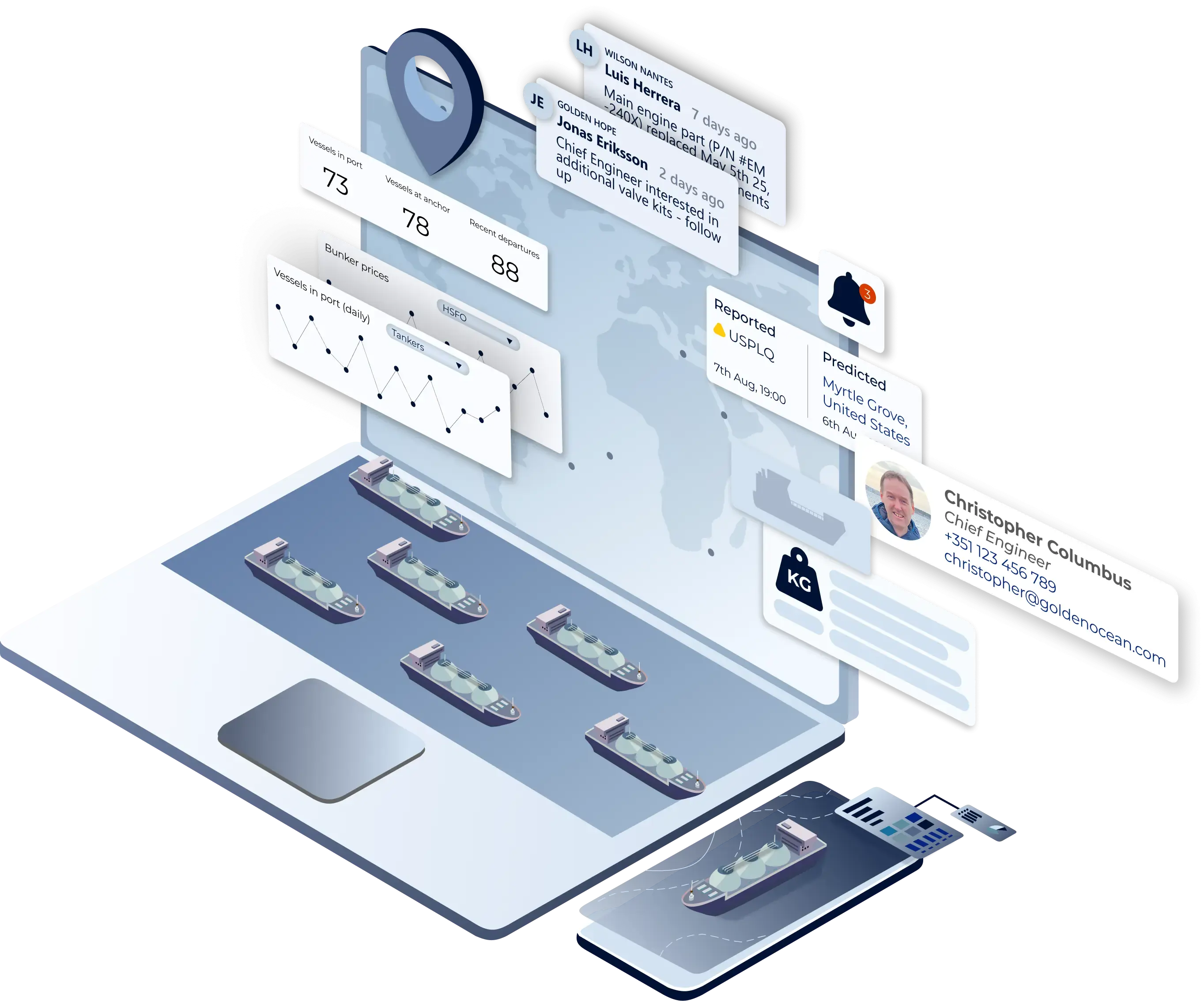
ShipIntel Essentials is an AI-powered maritime decision support system for teams and any type of company involved in maritime business so you can reduce manual work, create more business and provide better service based data driven insight.
ShipIntel Essentials delivers essential maritime features build on high-quality, real-time and historical AIS data enriched with other public maritime data and lets customers layer in their proprietary data for their private use.
In ShipIntel Essentials you will find real-time and historical AIS data on any type of vessel.
You can create vessel lists, receive email digest reports every morning based on criteria that matters to you, be notified when ShipIntel predicts the next destination (country or port), get live vessels lists automatically updated based on your criteria, vessel sanctions, turning off/on AIS, sea route calculator based on AIS service speed, information about different type of ownership, do a quick voyage calculations. Get a team contact book and email management and many more features.
All in one seamlessly integrated and affordable solutions.
Plan faster. Work smarter. Earn more.

An AI-driven decision support system for chartering and shipbroking
An AI-driven ShipIntel Pre-Fix helps commercial ship- and cargo owners / operators, reduce manual work and increase the TCE for your portfolio of cargoes, TC out, COA, TC in and owned vessels based on data driven insight.
ShipIntel is designed around familiar workflows and helps you and your team to automate tasks where possible, giving you more time to evaluate and make informed decisions
ShipIntel Pre-Fix is an add on to ShipIntel Essentials, so you get all the features from Essentials and email parsing for quoted cargoes TC in, TC out and COAs parsed and made machine readable, so can do quick calcs, pre-voyage calculations & compare many to many calculations and start negotiate and get the handover / fixture notes done when subs are lifted. Bunker planning, carbon emission calculation and APS delivery and redelivery is included.
You can also follow your team's progress and find how many cargoes you have been quoted, given an offer, etc. All in one seamlessly integrated and affordable solution
ShipIntel Pre-Fix helps you reduce manual work and increase the TCE for your portfolio of cargoes, TC out, COA, TC in and owned vessels based on data driven insight.
Plan faster. Work smarter. Earn more.

Maritime Optima collects live raw AIS data from satellites, terrestrial and dynamic AIS sources enriched by other publicly available maritime data, and an in-house built sea route engine. We clean, unify, and process the data in-house to provide high-quality AIS data for all types of vessels with global coverage.
Maritime Optima have developed a software that lets companies combine these high-quality maritime data with their proprietary data.
By applying machine learning and deep learning analytics to these data sets; in real-time as well as for historical data, Maritime Optima offer companies involved in maritime business the next generation decision support software.
ShipIntel is available on the App Store and Google Play Store, allowing you to work on the go. You and your team's activity and data is automatically synced between your devices.


Working in the maritime industry means you always have to explore opportunities in a rapidly changing and complex world. You must collect information to make the right decisions in a continuously changing world.
ShipIntel is built for instant communication and brainstorming sessions, bringing diverse perspectives together to tackle complex maritime challenges.
The ability to quickly share ideas, documents, and feedback fosters a culture of innovation.
ShipIntel’s user-friendly interface and collaborative features make it easier for team members to learn from each other and grow professionally.
Teams can assign tasks, track progress, and share updates in real-time, reducing delays and improving overall efficiency.
ShipIntel’s notification and notes system ensures that everyone is aware of changes and updates, reducing misunderstandings and promoting a collaborative environment where conflicts can be resolved quickly.

Explore our solutions through a live personalized demo where you ask the questions and we show you how to find the answers in ShipIntel.

We decided to change over to ShipIntel because it is a great and user-friendly ship tracking system with so much more. With over 50 vessels in our ship project finance portfolio, we need ship details, alerts, port info, traffic statuses and trends all the time. ShipIntel is a tool that easily gives us such information and connects our team.

ShipIntel is our go-to solution for portfolio monitoring. ShipIntel is a reliable software built on high-quality data, followed by excellent customer and user service. Exactly what we need to gain real-time insight to empower our team's strategic decision-making.

Having used several competing AIS providers, we were confident in our decision to add ShipIntel Essentials to our toolbox. We are impressed with its sleek, responsive, and easy-to-use interface and we're excited to leverage its full potential in our day-to-day operations. Maritime Optima has been very attentive, listening to our needs and implementing functions we have requested.

We started using ShipIntel because we needed an AIS software and a sea route calculator. We added more features because we gained access to high-quality AIS data, smart AI searches, and a very user-friendly software at an affordable price. There are too many stand alone softwares, and we have started looking for a kind of all in one software that gives us what we need at an affordable price.
We chose ShipIntel because it is an innovative solution, easy to use, and comes with a very competitive price. We continued using ShipIntel because the Maritime Optima team continuously develop and maintain the software. We also think it is an advantage that maritime software is developed by people that have been working in the industry. So the easy to use, relevancy, high AIS quality and price makes ShipIntel a unique maritime software box.

We believe ShipIntel stands out on key points such as coverage, search/filters/lists, and user interface. The highly skilled IT team is supplemented with experienced shipping people, so we are confident that ShipIntel will continue developing to our benefit.

