
STONE I
Tanker / Handy, IMO 9380582
Where is the vessel?
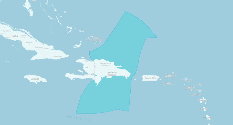
STONE I is currently in the Dominican (Republic) Exclusive Economic Zone, based on AIS data received less than 1h ago. Track STONE I live using high-quality AIS by registering a free account in ShipAtlas by Maritime Optima.
Track live positionWhat type of vessel is this?
STONE I (IMO 9380582) is a Tanker/Handy vessel built in 2008 and is sailing under the flag of Marshall Islands. She has an overall length (LOA) of 184 meters and a width (beam) of 27 meters. Her summer deadweight capacity is 37,889 tonnes.
Current voyage information

Register for free to view live position, current speed, draft, course and navigational status.
Last port calls
| Port name | Arrival time | Departure time |
|---|---|---|
|
Rio Haina (do)
|
Sunday 29th March | Tuesday 31st March |
 Puerto Yabucoa (pr)
|
Thursday 26th March | Friday 27th March |
 Sint Eustatius (bq)
|
Friday 13th March | Sunday 22nd March |
Frequently asked questions
Where is STONE I right now?
The current position of STONE I in the the Dominican (Republic) Exclusive Economic Zone, last seen less than 1h ago.
What type of vessel is STONE I?
STONE I is a Tanker classified as a Handy.
How big is STONE I?
STONE I is 184 meters long (LOA) and 27 meters wide (beam).
Vessel details
| Name | STONE I |
| Vessel type | Tanker / Handy |
| IMO | 9380582 |
| MMSI | 538009363 |
| Callsign | V7HX5 |
| Flag | Marshall Islands |
| Year built | 2008 |
| Draft (summer) | 11.515 meters |
| Deadweight (DWT) | 37,889 tonnes |
| Length overall (LOA) | 184 meters |
| Width (beam) | 27 meters |


